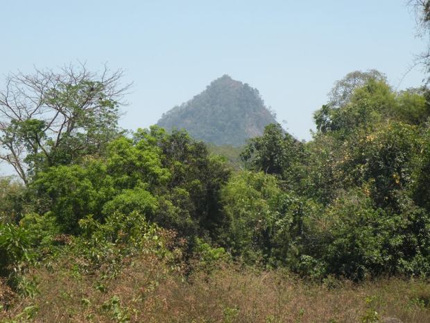
 A mountain that lies behind Mt Malasimbu (conic-shape mountain) rising 696MASL, sitting beside with it is Mt Tambo. The mountain is characterized by plenty of wild Banana shrub at it’s slope that Aeta people use this primarily as their source of livelihood, to sell banana fruit and blossom on very cheap price. We were told by Aeta people that we were the first outsider that they take it up and reach to that area.
There are 2 possible route:
- From Brgy Bayan-Bayanan jump-off (barangay hall) will take 4-6hours one way up.
- From Mt Malasimbo traverse will take 6-8hours
Difficulty is classify between easy on the initial part but the assault from Mt Terranos to Mt Kihandal is the steepest and most heart pounding. The ground or lahar can easily erode so you need a reliable grip but some of the banana’s trunk body is very soft to grab and slippery too. Should I say 4/9 in terms of rating?
The author been twice here at this mountain first is the Mt Malasimbo-Mt Terranos-Mt Kihandal Traverse then followed by normal back trail. The article will tackle only the back-trail route. I am hesitant to post this one not to disturb the Aeta people living there but this might be good as well to provide them livelihood for guiding as they are living on the poverty line. All I’m asking if the hiker will go up there, include the charity works for the Aeta children and respect the people out there.
A. Narration of the Climb
On my previous plan, my team was set to climb Mt Malasimbo and traverse it to another mountain behind it. I made thorough research but I could only find Mt Terranos. This give me idea that if we could look for a guide much better to lead us too in Mt Terranos as reference. On our first attempt when we traverse the mountain, it is a long way path and very punishing scorching sun taking toll on our bodies.
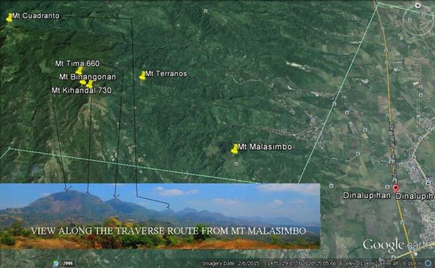
The mountains behind Mt Malasimbu
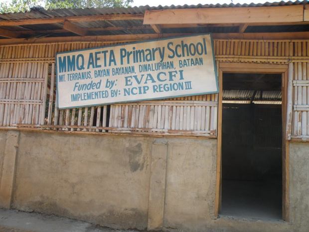
 When we arrived at Mt Terranos, we were surprised that it doesn’t look like a mountain as we were passing on the local footpath. The landmark of the Mt Terranos is the primary school of indigenous aeta children. The people there recommend us to go up there in the mountain to see the view. It happens that the guide also knew that area so we proceed which at first the guide reluctant because he has the long way to go back but later on we managed to convince him. After successful attempt, there is a road that lead us to the civilization. This gives me idea of having the backtrail route which leads me to assemble another batch of hike together with my buddy.
Same setup I did before, we took a bus from Victory Liner Cubao bound to Olongapo. We told to the driver to drop at Dinalupihan Market and get the tricycle to Brgy. Bayan-Bayanan Hall. We disembarked at the barangay hall however our guide which I communicated before didn’t response so I was saddened on the development. Only few or none at all from the people venture up to Mt Terranos. So my idea was to get guide to lead us at Mt Terranos then look for aeta guide that will us to the mountain of Mt Kihandal. All I need is to get the direction of the road leading to Mt Terranos and from there will arrange separately.
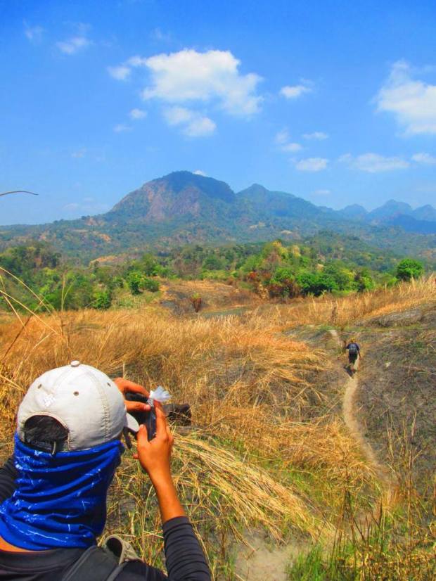
The trek is start first passing on the uphill paved road then stop on certain point leading to the bush. There is a local trail footpath. From the bush trail path will emerge on the open road heading to Mt Terranos.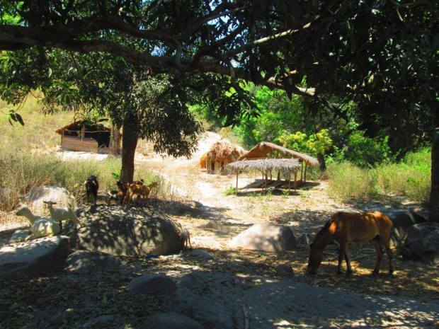
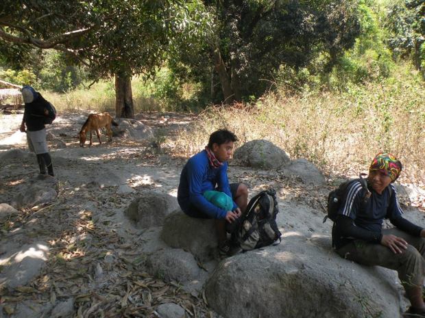
The first attempt to Mt Kihandal, road leading to Mt Terranos. Enjoying couple of rest and shelter us from the sun.
It is very straightforward however it is very hot, there is only few trees to shelter with. There are plenty of mango trees here wherein the locals sell it to the people in lowland. After 2 hours of initial start, we reached Mt Terranos.
Mt Terranos
Perspective view of Mt Malasimbu from Mt Terranos
From there, we look for the guide by showing them the picture of where we got the shot before. There are too many mountains surrounding there and by pinpointing the landmark, they can identify the location. From Mt Terranos to Mt Kihandal is another 2 hours hike. Uphill hike passing through some gardens then later entering to the bush. The path that we took when we first ascend on the slope is different from the path that my 2nd guide lead us but in the end, both will meet at common point.
The slope is entirely steep and ground made of sand is very unstable so we exert a lot of effort just to cling on our dear life. 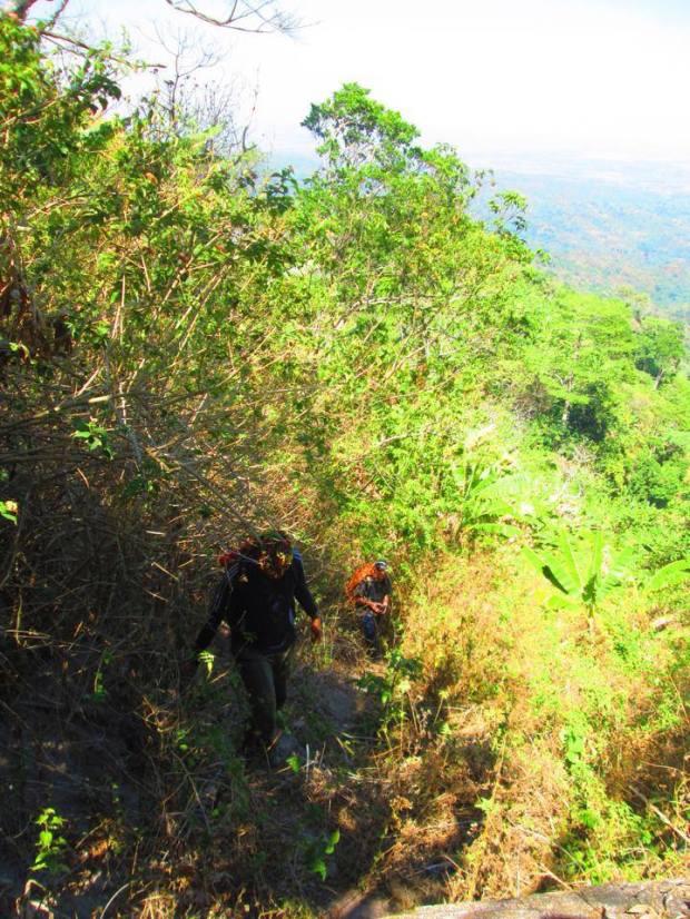 The 2nd guide allow us through steep woodland forest then leading to the Banana forest which is much better because you are not weaken by very hot sun. The first one lead us on the banana forest all the way up.
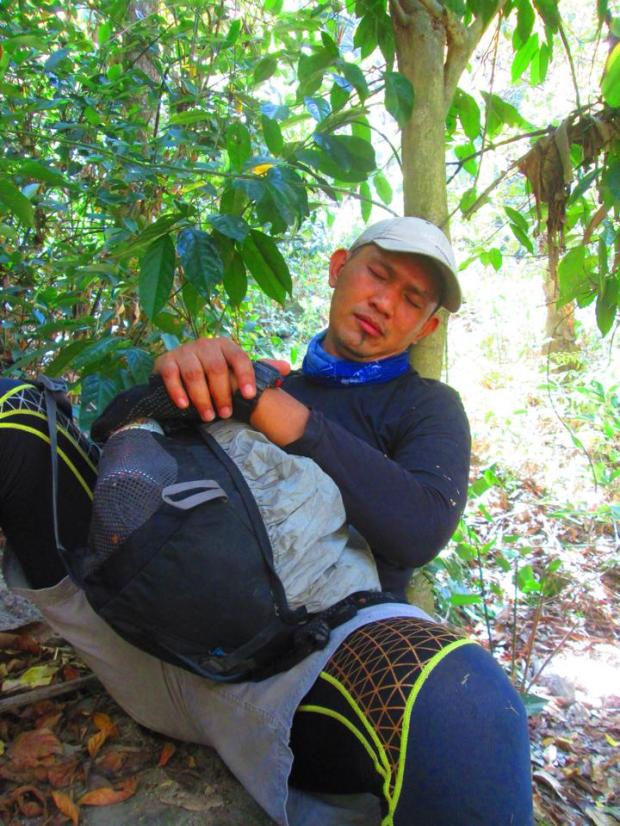
Roy took a nap, sleepless after his duty and long hike from Mt Malasimbo
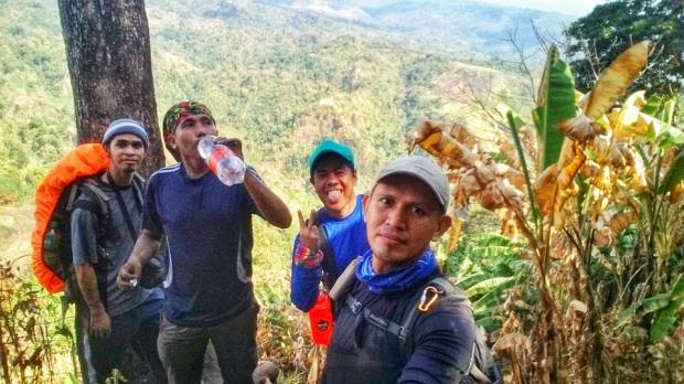
So very thirsty, luckily I replenish my water at Mt Terranos
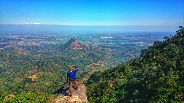
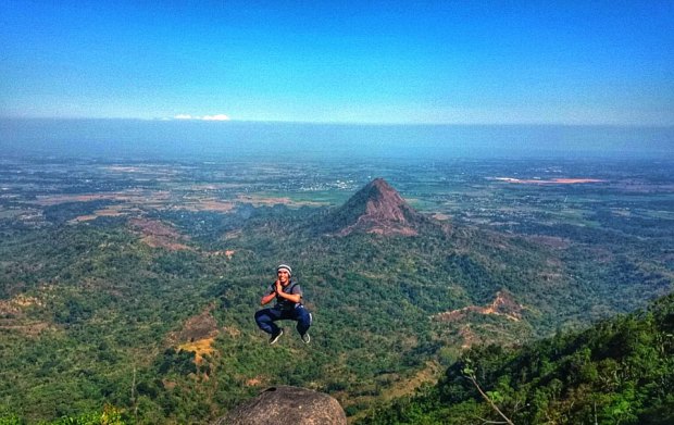
After 2 hours of scrambling across the slope we finally emerge on the narrow ridge slope which is also the summit but before reaching it you must cross the big boulder of the rock estimated 5 feet high. The highlights of the summit is the overhang rock which shape like tounge and having a good vantage scenery of Mt Malasimbo, the plain of Bataan and Mt Terranos at the bottom.
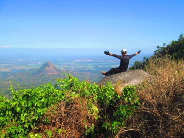
Dangerous stunt by Benjie
Spectacular View on top
Be careful not to get at the edge because it is a free fall down to the slope and rescue will be very difficult as the bottom is inaccessible.
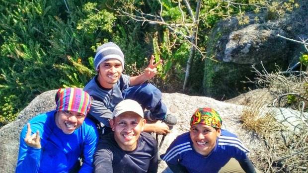
With our Aeta guide
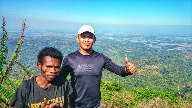
Roy and our guide
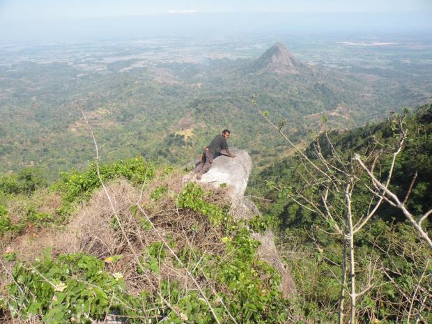
Take us one stop closer to the edge
We didn’t stay too long at the summit because it is approaching at noon time.
It took us 2.5hours to get on our way down and reached the jump off by 2pm. We just a short merienda at the barangay Bayan-Bayanan before leaving. All the way down is straightforward. By 5:30PM, we were back in Manila.
B. Suggested Itinerary
3:30AM Assemble at Victory Liner Cubao (get bus bound to Olongapo, don’t take the SCTEX)
4AM ETD
6AM ETA Dinalupihan Market, have a breakfast and buy food supplies
6:20AM Departure, board tricycle
7AM Arrival at Brgy. Bayan-Bayanan community, look for a guide that take you to Mt terranos or road to Mt Terranos. Pay them at least 150 for a short hike
9AM ETA Mt Terranos, landmark is school. Watersource is available
11AM ETA Mt Kihandal 686MASL
2PM ETA Back at Jump off
3PM ETA Layac Junction
5:30PM ETA Manila
C. TIPS
- Arrange guide from Brgy Bayan-Bayanan to lead you at Mt Terranos or the road leading to Mt Terranos.
- Arrange guide from Mt terranos to Mt Kihandal, there are natives there who knows the place
- For traverse coming from Mt Malasimbo, at the hut below the summit of Mt Malasimbu, there is aeta guide who you can ask for assistance and offer monetary.
- Commonly, we paid 500 pesos per day for the Aeta Guide. Be generous to them.
- Watersource is only available at Mt Terranos close to school. Ask permission
- The first part up to Mt Terranos is very hot but you are cover under the canopy of the trees when you reached the slope of Mt Kihandal
- Be careful on your steps as most of the time it is unreliable
- Make sure your guide is equip with bushknife to clear the way to the tounge.
- Our expense cost us less than 600 pesos back and forth to manila including the guide fee.
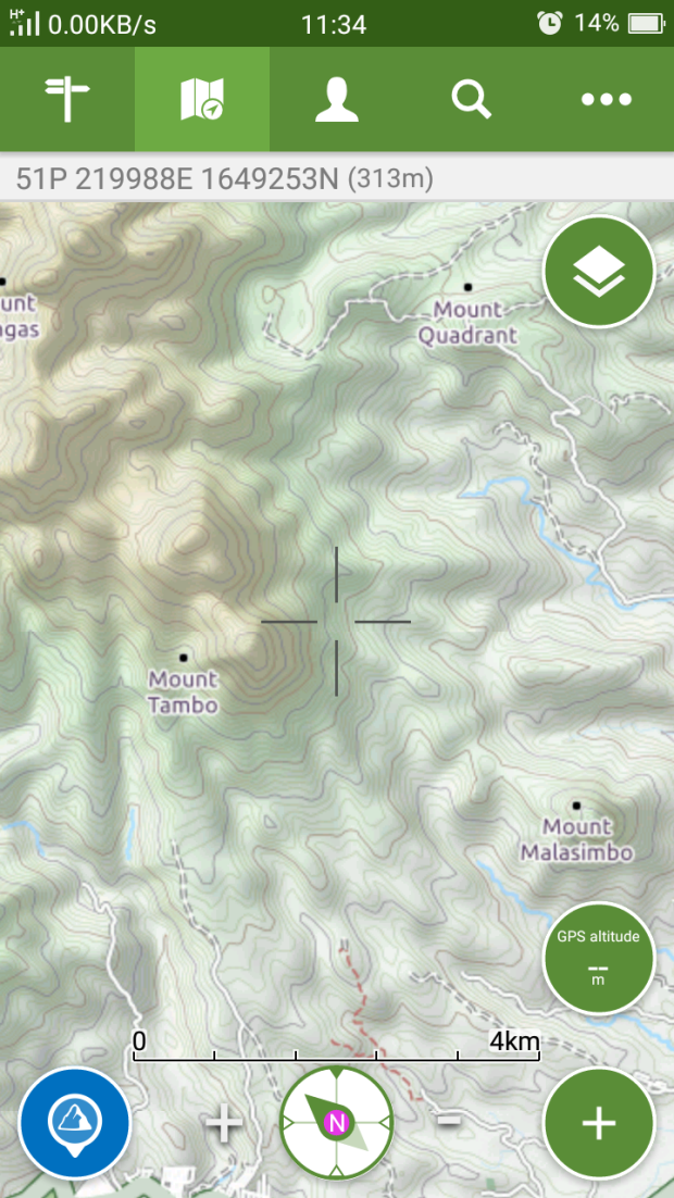
D. Maps